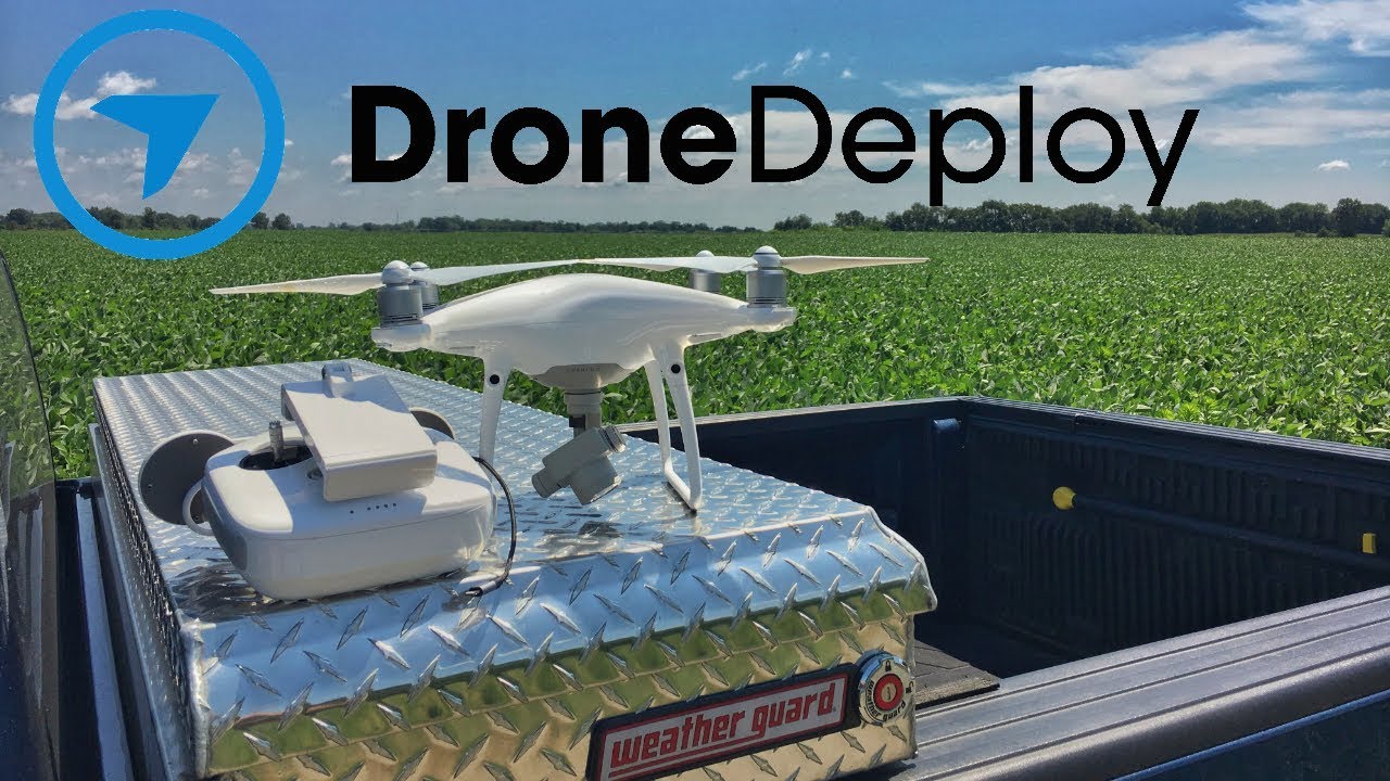
How to use drone deploy – How to use DroneDeploy? It’s easier than you think! This guide walks you through everything from setting up your account and planning flights to processing data and sharing your results. We’ll cover the basics, delve into some advanced features, and even troubleshoot common problems. Get ready to unlock the power of aerial data acquisition!
DroneDeploy simplifies the entire drone workflow, from initial planning and flight execution to data processing and analysis. We’ll explore the platform’s core features, including flight planning tools, data processing options (like orthomosaics and 3D models), and collaboration features. You’ll learn how to create professional-quality maps and reports, regardless of your experience level.
Getting Started with DroneDeploy
DroneDeploy is a cloud-based platform that simplifies the entire drone workflow, from flight planning to data analysis. This section will guide you through the initial setup and account creation process, explaining the different subscription options and best practices for configuring your drone profile.
DroneDeploy Platform Functionalities
DroneDeploy offers a comprehensive suite of tools for drone operations. Core functionalities include flight planning, data capture, processing, analysis, and collaboration features. Users can create detailed flight plans, automate data collection, process images into various deliverables like orthomosaics and 3D models, and easily share projects with colleagues. The platform also provides robust analytics tools for extracting insights from aerial data.
Creating a DroneDeploy Account
- Visit the DroneDeploy website and click on “Sign Up”.
- Choose your preferred method of registration (email or social media).
- Fill out the required information, including your name, email address, and company (if applicable).
- Verify your email address by clicking on the link sent to your inbox.
- Once verified, you can log in to your DroneDeploy account and start exploring the platform.
DroneDeploy Subscription Plans

DroneDeploy offers several subscription plans catering to different needs and budgets. These plans typically vary in terms of data storage capacity, processing speed, and access to advanced features. A basic plan might offer limited data processing capabilities, while higher-tier plans provide more processing power, storage, and advanced analytical tools. It’s advisable to review the detailed feature comparison on the DroneDeploy website to select the plan best suited to your requirements.
Setting Up Your Drone Profile
Accurate drone profile setup is crucial for precise flight planning and data processing. This involves specifying your drone’s make, model, camera type, sensor specifications, and other relevant details. Ensure that all parameters are accurately entered to avoid errors during flight planning and data processing. DroneDeploy provides detailed instructions and guidance on how to configure your drone profile correctly within the platform.
Planning Your Drone Flights with DroneDeploy
Effective flight planning is essential for efficient data acquisition. This section details how to design a flight plan using DroneDeploy, emphasizing the importance of accurate Ground Control Points (GCPs) and adapting to varied terrain and weather.
Designing a Sample Flight Plan
Let’s plan a flight over a 100m x 100m square area. We’ll set the altitude to 50 meters, with a 70% side overlap and 60% front overlap to ensure sufficient image overlap for accurate processing. The camera settings will depend on your drone and sensor, but a typical setting might be a 12MP camera with a 24mm equivalent focal length.
The flight plan should be designed to cover the entire area systematically, ensuring complete image coverage with optimal overlap.
Importance of Ground Control Points (GCPs)
GCPs are physical points with known coordinates on the ground. They are essential for georeferencing the drone imagery, ensuring accurate positioning and alignment of the final output. Accurate GCP placement is crucial for minimizing geometric errors in the processed data. GCPs should be evenly distributed across the area of interest, avoiding clustering in one location. Consider using highly visible and stable markers that are easy to identify in the drone imagery.
Flight Planning Methods
DroneDeploy offers several flight planning methods, including manual planning and automated planning. Manual planning provides more control over individual flight parameters, while automated planning streamlines the process, generating efficient flight paths based on the specified area and parameters. The choice of method depends on the complexity of the area and the user’s experience level. Automated planning is generally recommended for larger and more complex areas.
Adjusting Flight Parameters for Terrain and Weather

Flight parameters, such as altitude, speed, and overlap, should be adjusted based on terrain variations and weather conditions. In areas with significant elevation changes, a variable altitude flight plan might be necessary to maintain consistent ground sampling distance. Adverse weather conditions, such as strong winds or rain, may necessitate postponing the flight or adjusting parameters to ensure safe and successful data acquisition.
DroneDeploy’s flight planning tools allow for customization based on these factors.
Executing Drone Flights and Data Capture: How To Use Drone Deploy
This section covers pre-flight checks, data upload procedures, troubleshooting common issues, and maintaining consistent flight parameters for optimal data acquisition.
Pre-Flight Checklist
- Check battery levels and charge if necessary.
- Inspect the drone for any damage or loose components.
- Verify GPS signal strength and accuracy.
- Ensure the camera is functioning correctly and memory card is adequately formatted.
- Review the flight plan and confirm all settings are correct.
- Check weather conditions and ensure they are suitable for flight.
- Obtain necessary permissions and comply with all relevant regulations.
Uploading Flight Logs and Data
After completing the flight, upload the flight logs and data to the DroneDeploy platform. DroneDeploy typically supports various data formats. The platform provides detailed instructions on how to upload data efficiently and securely. Successful upload is confirmed by the platform, indicating that the data is ready for processing.
Troubleshooting Common Issues
Common issues during drone flights include GPS signal loss, low battery, and camera malfunctions. Addressing these promptly is crucial for data integrity. GPS signal loss can be mitigated by flying in open areas with a clear view of the sky. Low battery issues can be avoided by carrying extra batteries and monitoring battery levels throughout the flight.
Camera malfunctions might require a reboot or replacement of the camera.
Maintaining Consistent Flight Altitude and Speed
Maintaining consistent altitude and speed during the flight is essential for achieving uniform image overlap and minimizing geometric distortions. DroneDeploy’s automated flight modes help maintain consistent flight parameters. However, manual adjustments may be necessary in challenging terrain or weather conditions. Consistent flight parameters are key to obtaining high-quality data for accurate processing and analysis.
Processing and Analyzing Drone Data in DroneDeploy
This section explains the various processing options available in DroneDeploy, error correction methods, and organizing processed data for effective reporting.
DroneDeploy Processing Options
DroneDeploy offers various processing options, including orthomosaic creation, 3D model generation, and digital surface models (DSMs). Orthomosaics provide a georeferenced mosaic of images, ideal for measurements and analysis. 3D models offer a three-dimensional representation of the area, useful for visualization and volume calculations. DSMs depict the terrain’s surface elevation, valuable for terrain analysis.
Identifying and Correcting Processing Errors
Processing errors can arise due to insufficient image overlap, poor GCP accuracy, or camera malfunctions. DroneDeploy’s processing engine typically identifies potential errors during the processing stage. These errors can be corrected by re-flying the area with improved parameters, adding more GCPs, or addressing camera issues. The platform provides tools and feedback to guide users in identifying and correcting errors.
Accuracy and Resolution Comparison
The accuracy and resolution of the processed data depend on several factors, including the drone’s camera resolution, flight altitude, image overlap, and GCP accuracy. Higher resolution cameras, lower flight altitudes, and higher overlap levels generally lead to higher-resolution and more accurate data. The accuracy of GCPs is also a significant factor influencing the overall accuracy of the processed data.
DroneDeploy provides metrics to assess the accuracy and resolution of the processed data.
Organizing Processed Data for Reporting
Organize processed data into a user-friendly format for clear and concise reporting. This might involve creating maps, charts, tables, and other visual aids to effectively communicate findings. Use clear and concise labels, legends, and scales to ensure easy interpretation of the data. Export data in commonly used formats for seamless integration with other software platforms.
| Data Type | Units | Typical Use | Example |
|---|---|---|---|
| Orthomosaic | Pixels | Visual inspection, measurement | High-resolution image of a construction site |
| Digital Surface Model (DSM) | Meters | Volume calculations, terrain analysis | Elevation data for a mining site |
| 3D Model | Meters | Visualization, 3D measurements | 3D model of a bridge |
| Point Cloud | XYZ coordinates | Precise measurements, 3D modeling | Point cloud data for a forest inventory |
Sharing and Collaborating on DroneDeploy Projects
DroneDeploy facilitates seamless collaboration and data sharing, enhancing project management and communication. This section describes various methods for sharing processed data and integrating DroneDeploy with other software platforms.
Sharing Processed Data
DroneDeploy offers various methods for sharing processed data, including direct download, cloud sharing, and integration with other platforms. Users can easily share projects and data with collaborators via email, links, or direct integration with project management software. Access control features allow users to manage permissions and restrict access to sensitive data.
Project Management and Communication
DroneDeploy incorporates features for project management and communication, including task assignments, progress tracking, and real-time communication tools. These features streamline collaboration and ensure efficient project execution. Users can track project progress, assign tasks to team members, and communicate effectively within the platform.
Creating and Exporting Reports
DroneDeploy allows users to create professional reports directly from the platform. These reports can include maps, charts, tables, and other visual aids to effectively communicate project findings. Users can export reports in various formats, such as PDF, CSV, and other commonly used file types.
Integrating DroneDeploy with Other Software, How to use drone deploy
DroneDeploy integrates with various other software platforms, including GIS software, CAD software, and project management tools. These integrations streamline workflows and enhance data analysis capabilities. Seamless data transfer between platforms eliminates the need for manual data entry and reduces errors.
Getting started with drone mapping? Planning your flight path is key, and DroneDeploy makes it easy. Check out this awesome tutorial on how to use DroneDeploy to learn about mission planning and data processing. Once you’ve mastered the basics of how to use DroneDeploy, you’ll be creating stunning aerial imagery in no time!
Advanced DroneDeploy Features
This section explores advanced features like time-lapse creation, volumetric calculations, and progress tracking, comparing DroneDeploy’s capabilities with other drone mapping software and showcasing its applications in various industries.
Advanced Feature Elaboration
DroneDeploy offers advanced features such as time-lapse creation for monitoring construction progress, volumetric calculations for accurate volume estimations in mining or agriculture, and progress tracking tools for project management. These features enhance the platform’s capabilities and expand its applications across various industries.
Comparison with Other Software

Compared to other drone mapping software, DroneDeploy stands out with its user-friendly interface, comprehensive feature set, and cloud-based platform. While other software may offer specific advantages in certain areas, DroneDeploy provides a holistic solution for the entire drone workflow. The choice of software depends on specific needs and preferences.
Industry Applications
DroneDeploy finds applications in various industries, including agriculture (crop monitoring, yield estimation), construction (progress tracking, site surveying), mining (volume calculations, stockpile management), and infrastructure inspection (bridge inspections, pipeline monitoring). The platform’s versatility makes it suitable for diverse applications.
Hypothetical Project: Monitoring Construction Progress
Let’s consider a hypothetical project: monitoring the progress of a large-scale construction project. DroneDeploy’s advanced features can be used to effectively manage this.
- Establish regular drone flights to capture aerial imagery.
- Use DroneDeploy’s flight planning tools to create efficient flight paths.
- Process the imagery to generate orthomosaics and 3D models.
- Use time-lapse features to create a visual representation of construction progress.
- Compare data from different flights to track progress against the schedule.
- Share progress reports with stakeholders using DroneDeploy’s collaboration features.
Troubleshooting and Support
This section provides solutions to common errors, details support channels, and offers tips for optimizing DroneDeploy performance. A flowchart illustrates the troubleshooting process for a failed data upload.
Common Errors and Solutions
Common errors include data upload failures, processing errors, and account access issues. Data upload failures can often be resolved by checking internet connectivity, verifying file formats, and ensuring sufficient storage space. Processing errors can be addressed by reviewing flight parameters, GCP accuracy, and image overlap. Account access issues can be resolved by contacting DroneDeploy support or resetting your password.
Support Channels
DroneDeploy offers various support channels, including online documentation, a knowledge base, email support, and phone support. Users can access comprehensive documentation and tutorials on the DroneDeploy website. Email and phone support provide direct assistance from DroneDeploy’s technical team.
Optimizing DroneDeploy Performance
Optimizing DroneDeploy performance involves ensuring adequate internet connectivity, using the latest version of the software, and regularly clearing cache and temporary files. Maintaining a stable internet connection is crucial for efficient data upload and processing. Updating the software to the latest version ensures access to bug fixes and performance improvements.
Troubleshooting Flowchart (Failed Data Upload)
A flowchart for troubleshooting a failed data upload would start with checking internet connectivity, then proceed to verifying file formats and storage space. If these checks fail to resolve the issue, contact DroneDeploy support for further assistance. The flowchart would visually represent these steps and decision points, guiding users through the troubleshooting process.
Mastering DroneDeploy opens up a world of possibilities. Whether you’re a seasoned professional or just starting out, this guide has equipped you with the knowledge to efficiently plan, execute, and analyze drone flights. Remember to leverage the platform’s advanced features to maximize your results and explore the diverse applications of drone data across various industries. Happy flying!
Key Questions Answered
What types of drones are compatible with DroneDeploy?
DroneDeploy supports a wide range of drones from various manufacturers. Check their website for the most up-to-date compatibility list.
How much does DroneDeploy cost?
DroneDeploy offers various subscription plans catering to different needs and budgets. Pricing details are available on their website.
Can I use DroneDeploy offline?
No, DroneDeploy requires an internet connection for most of its functionalities, including flight planning, data processing, and sharing.
Getting started with drone mapping? First, you’ll need a solid flight plan. Then, check out this awesome guide on how to use DroneDeploy to learn the software’s ins and outs. Mastering the software is key to creating professional-looking maps and reports from your drone data, so take your time and explore all the features. Using DroneDeploy effectively will really boost your drone workflow.
What kind of support does DroneDeploy offer?
DroneDeploy provides various support channels, including online documentation, FAQs, and direct customer support.
